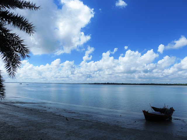
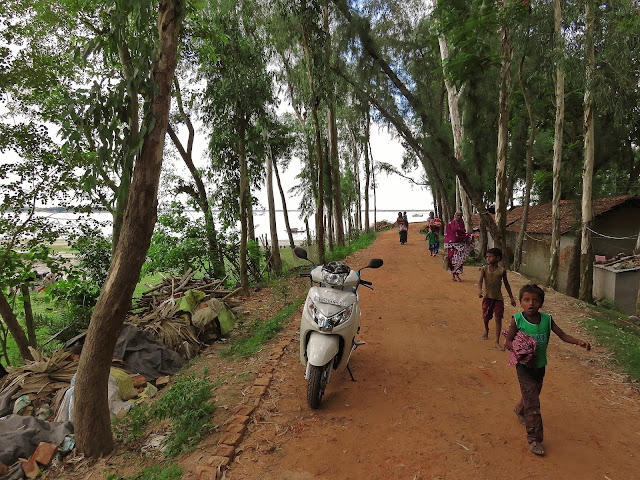
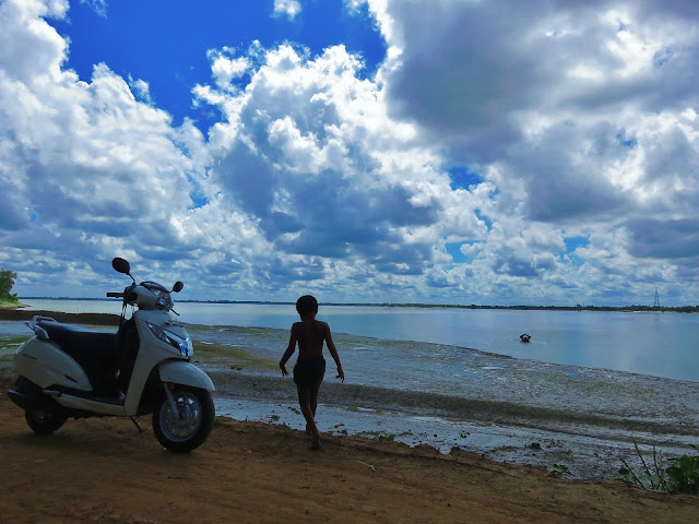
The confluence of the three rivers at Gadiara
Gadiara, situated at the confluence of rivers Damodar, Rupnarayan & Hoogli is quite popular travel destination. The quaint place in Howrah district has it’s own charm and a great weekend getaway where you can just spend some quite time with a view of the vast flowing rivers. There is no activity, just nothing to do, you just laze around here. Across the rivers are two more similar spots, Nurpur in South 24 Pargana & Geonkhali in East Midnapur. You can take a ferry from Gadiara across the river and visit these places. You will be touching three different districts of West Bengal within few hours just by crossing rivers.
This is the view which greets you as you reach Gadiara
Another view of the river
On the way to Fort Mornington
My scooter facing the river
The road to the tourist lodge
As I said there most of the travelers who had been there and had soaked in the tranquil nature would not be aware of a piece of history which in all literal sense is submerged under water. There is a fort, or I should say there was a fort built by the British at this very place during the regime of Robert Clive. This was the Fort Mornington. But wait, it’s nothing what your mind conjures up the moment someone says the word ‘fort’. If you are imagining imposing stone walls, surrounding creek, towering gate and turrets lined up with guns you still need to travel to Rajasthan. All you see here is remnants of a brick structure, looking similar to the top of a broken wall, almost submerged in the river in front of the Govt. run tourist lodge. During high tides this may just vanish under water.
Yes you see that line in the river, that's all it remains of the fort Mornington today
Today looking at the ruins it’s hard to imagine this as a fort. Nobody now really knows how the fort looked before it was engulfed by the erosion of the riverbank. Not much historical reference can be found except a mention on the ‘Howrah District Gazette 1909, which reads “Fort Mornington Point. — A point in the extreme south of the district at the junction of the Rupnarayan with the Hoogli. On this point there formerly stood a fort, said to have been built by Lord Clive, which fell into the river owing to the erosion of the bank”. Whatever was remaining was further destroyed during the great cyclone which hit this area in the year 1942.
The location was no doubt very strategic. Situated at the confluence of three rivers the fort would have played critical role from a military standpoint as dominance over the river traffic was essential in those days. In those turbulent times where trade and commerce as well as military movement for East India Company largely dependent on riverways, it was all but important to ensure dominance for safe passage of vessels. Top on Clive’s mind would be the burgeoning French colony at Chandannagar and the Dutch settlement around Srerampore, who were the fiercest competitor of the British who also ran their business through the same waterway.
Another view of the ruins
It is also not known why the fort was named ‘Mornington’. There is a small hamlet in Ireland by the same name but finding link between the two is very difficult. You can go thru’ the following blog which tries to throw some light on the name.
Further up the dirt road as it took a left turn, the remains of an old lighthouse can also be seen.
Road to the lighthouse
It isn’t very tall or big, just a chimney like brick structure, square shaped and narrows down gradually towards the top. A series of iron rings riveted on the left and an iron ladder passes through it which was used to climb to the top. A few meters of the ladder was missing from the base making it impossible to climb to the top now.
The lighthouse. You can make out the iron ladder with ring shaped girders
I could not understand how the light was lit at the top in those times. It could have been a oil fired one but I am not sure as there is nothing left which would suggest how the light burned at the top. Houses of local residents have come up surrounding all three sides of the old lighthouse making it impossible to venture onto the back side to see if that revealed any more clues.
The encroachment at the base of the lighthouse
There is no sign of ASI board or anything from the authorities that this would be a protected monument. With no attempt for preservation, days are not vary far when this will also be obliterated.
The ferry ghat where you can take a vessel to crossover to Nurpur or Geonkhali
So if you are looking at a lazy weekend by the river with a little tryst with history, Gadiara can definitely be your next destination.
Lazy boat. You can talk to local people and hire such a boat for a leisurely cruse on the river
HOW TO REACH:
 |
| NH-6 On the way to Gadiara |
Gadiara is only about 90 kms from Kolkata. The roads are excellent all through. I travelled with my Honda Activa scooter with a pillion. It was smooth sailing all along and the small honda pulled beautifully over the smooth surface. It will be approximately 2 hours journey. First you have to take NH 6 towards Kolaghat. Then you have the option of turning left either from Uluberia which comes first or continue upto Bagnan and then take left. I took the Bagnan route while going. It’s a single lane road once it branches out of NH-6. A 34 km stretch all the way to Gadiara where the road ends at a T junction on the river bank. This road is smooth all along, only that it passes through thickly populated areas and there are at least four spots where there is a bazar right on the road where you are bound to get entangled in a huge mess of buses, trucks, auto-rickshaws, motorcycles, cycle vans, cows and thousands of people milling around. So it needs some careful driving and this road is also dotted by unmarked speed breakers which might catch you unaware if not alert. So all you need is patience and careful driving.
While coming back I took the route which ends up at Uluberia. This is almost of same distance but the road is relatively free of traffic compared to Bagnan route. The surfacing is also good and I never had any problem with the scooter. This road will also take you through Garhchumuk, a deer sanctuary & 58 gate, which is essencially a dam built over gates The only trouble is when you approach Uluberia town to take NH6. Inside the town is very crowded and the last 5-6 kilometers can be a botheration. You also need to cross a rail gate which is on the busy SE railway tracks where lot of suburban and other long distance trains pass and might take time to cross. The Bagnan route taked you across through a flyover which is a boon. I felt time taken would be same more or less whichever route you follow. Both the routes merge at a place Shyampur and then goes staright to Gadiara.
At Gadiara where the road ends, you can see the vast expanse of the river in front of you. The narrow but motorable & metalled road on your left takes you to the Gadiara Govt tourist lodge which is about a kilometer away at the most. Just after the tourist lodge the road turns into a dirt trail and few meters ahead you would be able to see the ruins of fort Mornington in the river it’s low tide. A 100 meters walk ahead and you should be able to see the lighthouse on your left.
This place is also easily reachable by bus & train. If you come by train you need to get down either at Uluberia or Bagnan and then catch a bus to Gadiara. There are direct bus services from Kolkata to Gadiara. I could see CTC buses plying regularly. Just enquire about the timings if you are going for a day trip. Cycle vans are available locally to take you around.
WHERE TO STAY:
The Govt. run Rupnarayan tourist lodge is of course the best option here. Its right on the river and with a huge lawn.
The tourist lodge can be booked in advance from the West Bengal Tourism Development Corporation (WBTDC) website.
There are some private hotels as well. You can look at CHALANTIKA and The Hotel Sabar Upare
There are some more small private hotels on both sides of the road as you proceed towards Rupnarayan lodge however most of them are shady and mostly used by couple looking for few hours of privacy.
WHAT TO EAT:
There is hardly any place here where you can have a decent meal. If you pre-book, then lunch may be arranged at the tourist lodge. Alternatively you can approach the afore mentioned private hotels for lunch.
But there are no more options beyond roadside tea stalls where you can have tea, biscuits, bread and may be an occasional omlette. If you are going for a day trip you may carry some food with you. There are concrete tree shaded benches along the river bank where you can sit and enjoy your meal in peace with a view of the river. If you are staying at the tourist lodge then of course your meals are taken care of. If you are into hard drinks, better carry your own poison from Kolkata.
However it’s a very pleasant experience to sip a hot ‘bhar’ of tea, with the cool breezes from the river caressing your face.


Wonderful write up as usual dada. The way you merged history and a weekend gateway is really cool.
ReplyDeleteLoved going through this.
wonderful sir
ReplyDeleteKhasa lekha hoyeche. Good amount of information. Loved the narrative.
ReplyDeleteKhasa lekha hoyeche. Good amount of information. Loved the narrative.
ReplyDeleteI just saw your blog, there is another road, and that's fantastic, take left just before Damodor river bridge (after Uluberia, and Kulgachhia), the road will take you there - and teh road is built by the side of Damodor..there is no traffic jam and you don't have to cross any town
ReplyDeletehttps://www.google.co.in/maps/dir/kolkata/gadiara/@22.4487255,87.9737471,12z/data=!4m19!4m18!1m10!1m1!1s0x39f882db4908f667:0x43e330e68f6c2cbc!2m2!1d88.363895!2d22.572646!3m4!1m2!1d88.0041613!2d22.4599836!3s0x3a029ad7141a8e21:0x496aceb1c5b52088!1m5!1m1!1s0x3a028d2db907e4b3:0xb42f6012db99b5f8!2m2!1d88.0363086!2d22.2325723!3e0
What beautiful photographs!
ReplyDelete