 |
The first glimpse of Gangani and rivar Shilabati from the top |
The
River Shilabati took a sharp bend here and stacks of red laterite soil formed
deep gorges along the bank. In the distance the river bed turned white with the
blooming ‘Kaash’ flower announcing advent of autumn. The sky was overcast, in a
shade of drab grey. To my dismay it wasn’t the usual autumn cloudscape against
the canvas of a deep blue sky. Nevertheless the sight was breathtaking.
Welcome to Gangani, the Grand Canyon Of Bengal.
Some of you have been fortunate enough
to witness the iconic Grand Canyon in Arizona, USA. For the less fortunate, Bengal
has its own miniature grand canyon near the little town of Garhbeta in the
district of West Midnapore. This is only about 175 odd KMs away from Kolkata
where river Shilabati has cut through the rocks and laterite soil and created
this little wonder.
I
had been to Gangani sometime in the year 2013, but I could not spend much time
but I was smitten by the sheer beauty of this place and wanted to do a complete
photo documentation of the entire area. I planned to come back here sometime
soon but then finally it happened on September 17, 2017 when R.O.A.D (Revv On And Drive) a group of car & travel enthusiasts of which
I am a part, organized a one day drive to Gangani.
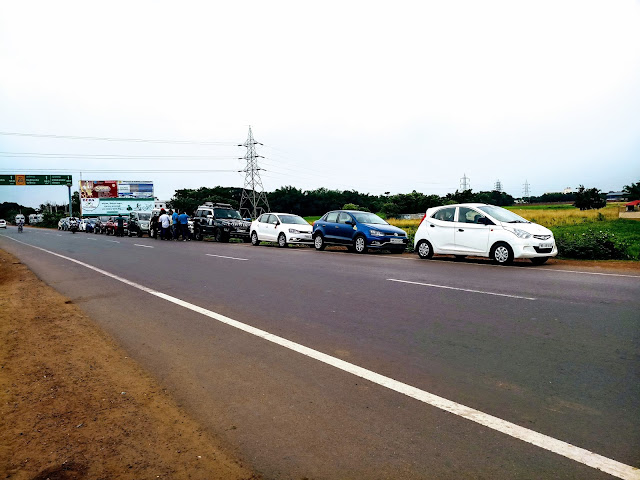 |
The journey begins. The convoy lined up at Dhulagarh Toll Plaza |
It
was a usual fun day with friends. Starting early in the morning we met up near
Dhulagarh toll plaza on NH-6 (Mumbai Road). Cars lined up and after few ‘Bhars’
of over sweetened tea and cigarettes the convoy headed towards Kolaghat.
Kolaghat,
just after crossing the bridge on river Rupnarayan is the usual hotspot for
breakfast for travellers on Mumbai Road. Here the road bifurcated towards
Haldia and popular beach destinations of Digha & Mandarmani, hence the hordes
of eateries and the dhabas on both side of the road are always abuzz with
tourist and business travellers alike.
Our
stopover was the NewTara Maa Hotel. The puffy white luchi coupled with alu-ghugni
curry is fantastic deal for breakfast and people gorged on platefuls. They also
make fantastic jumbo sized masala omelettes. However these guys go overboard
with the garnishing and sprinkle copious amount of red chili powder and crumbled
papads on top. So you need to tell them before hand to go easy and serve you
sans these toppings.
From
Kolaghat to Kharagpur it’s a clean run through six lane super smooth but rather
boring expressway. This stretch of about sixty five odd kilometers was passed
without much drama keeping a firm foot on the gas and needle hovering between
100 & 120kmph.
 |
The blooming Kaash on Rivar Kanshabati or kasai just ahead of Midnapur Town. |
The
fun starts after the turn right onto NH-60 from Kharagpur crossing towards
Midnapur town, which runs all the way to Ranigunj where it meets the NH-2. From
here the road turns into a single lane. Though narrow, but this 50 odd KM
stretch of road till Garhbeta is in good shape and runs through some beautiful
country. In this season the blooming ‘kaash’ flower is a sight to behold while
travelling. Just before Midnapur town we crossed the bridge over river Kanshabati.
I could see the abundance of ‘Kaash’ on the sandy bed of the river. It’s like a
white sea, the wind creating rippling waves sweeping across the field. As we
progressed, the lush green landscape slowly turns arid, the color of soil
gradually transforming to red and the road runs through beautiful stretches of
forest past quaint little hamlets of Godapiashal and Chandrakona. The black
shiny tarmac running through lush green forest is a treat to the eye.
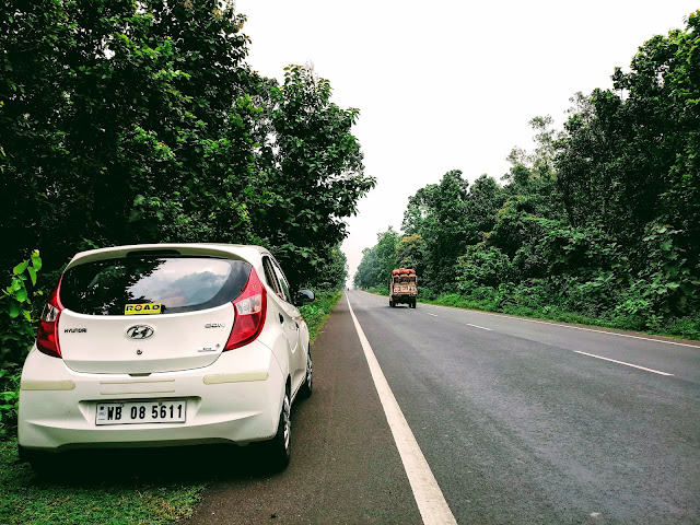 |
The stretch of NH 60 running through the forest |
We
made good time to Garhbeta. The drive was pleasant and we did not encounter heavy
traffic on this stretch. We only had to negotiate thru’ some busy intersections
near Salboni and Chandrakona.
From
Garhbeta a road branches out from NH-60 towards left and leads straight to
Gangani past the Garhbeta town. A few kilometers from Garhbeta, the habitation
thins out and the landscape opens up. There is a sign on the right showing a
gravel path leading to Gangani.
 |
The sight of the Canyon with river Shilabati in the background |
First comes a huge field, and as you move towards the river, the ground suddenly drops
off exposing the canyon. I was standing on the rim, on this narrow ledge high
up jutting out into the empty space. The scenery hits you the moment you stand
atop the rim of the gorge overlooking the flowing river far below. On the left tall stacks
of red laterite soil runs along the bank and made strange, almost surreal
formations. Thick rows of Kaash lined on both sides of the river. Far out on
the opposite bank of the river I could see fishermen casting net.
 |
Fishing on river Shilabati |
 |
The beautiful river side. |
 |
Again it was abundance of Kaash on the riverbank |
A winding concrete step goes down to the riverbed and then one can set to explore the interiors of the gorges and ravines on foot.
 |
The concrete staircase leading to the riverbed |
It
was almost noon and though the sun did not shine through the layers of grey
cloud, the heat was sweltering, hardly an ideal climate to explore the undulating
landscape. The light wasn’t perfect for photography. But the beauty is so mesmerizing
I decided to ignore the discomfort and do a photo documentation of the whole
area.
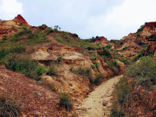 |
The narrow trails going inside the ravine |
As
I lurched & stumbled my way in through the narrow gravel strewn trails
leading inside the gorge, suddenly it was as if I was transported into a different
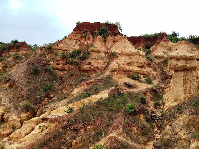
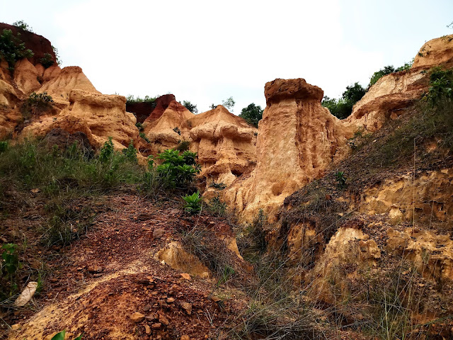
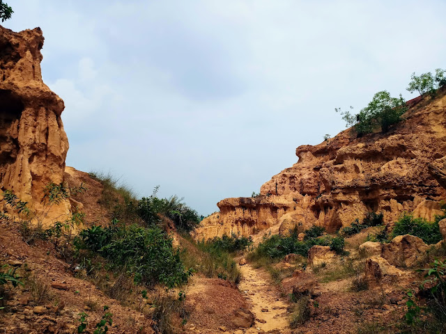
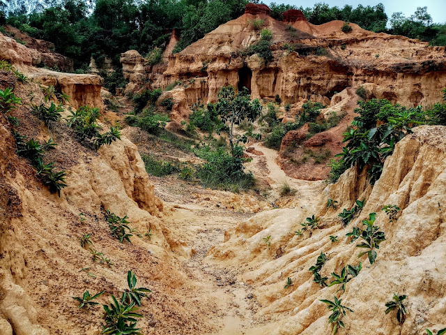
world. All around me, tall columns of hard laterite soil in amazing hue of
colors rose high. Their sun baked tops are in deep shade of red and gradually
melting into golden yellow towards the base. Over thousands of years, the
water of river Shilabati had been cutting through the hard laterite soil
creating gorges and the further deepening and widening it. The canyon is almost
70 feet deep. In the rainy months the rush of water flows through the
meandering ravines and swirling water makes strange and often bizarre shapes to
the Martian landscape through constant erosion. Certain parts looked like giant,
craggy faces of some aboriginal demigods, and it wasn’t too hard to imagine
few formations resembling some gigantic mythological animal. I could make out nebulous
shapes and forms which looked like ancient pillared citadels & temples in
ruins.
 |
Inside the ravines |
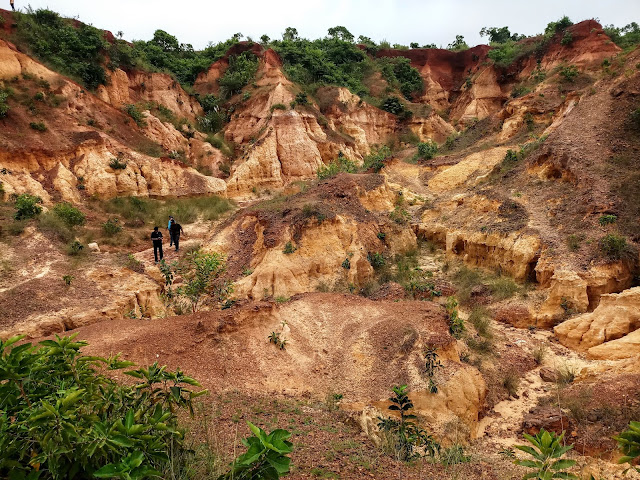 |
Top view of the area |
 |
The terrain difficult to negotiate but breathtakingly beautiful |
 |
Now I stood before the giant paw |
 |
Some more photos of the God's own sculpture |
 |
Note the intricate textures formed by years of erosion |
 |
The most interesting and one of the centers of attraction is a natural
cave in the shape of a temple, with a huge oblong opening. Though practically very
shallow, it gives an eerie feeling of dark unknown depths harboring some evil
monster inside. To further accentuate the creepy feeling, the soil formation on
the sloped pathway leading towards the mouth of the cave looks like as if you
are stepping past the giant carcass of a slain monster long buried deep and the
remnants of its mighty ribs surfacing out of the graveled ground.
 |
The approach to the temple like cave of Bakasura. Note the rib-cage like formation which appears like remains of some prehistoric monster. |
 |
Closure view of the cave |
 |
View from the inside of the cave. |
This
perhaps had given birth to the local folklore that this area was once the home
of the feared Bakasura, a character found in the Mahabharata. The legend goes
that the second Pandava, the mighty Bhimsen, during exile, had slain Bakasura
at this very place. The cave is referred as the home of Bakasura and it is believed
that the giant skeleton like formation is actually the petrified remains of the
demon.
However
the Mahabharta does have a reference that the Pandavas, during their exile
stayed at a place named “Ekachakrapura”. The demon Bakasura lived in a cave on
the nearby hill. Every week the villagers had to send one man or woman amongst them
on a bullock cart loaded with meat, rice, curds, intoxicating liquors and many
other delicacies to the Rakshasha, who would consume all including the humans. Bakasura
had conquered their land and went on a rampage to loot and kill indiscriminately.
Apparently the villagers came to this settlement with the demon that every week
they will sent whatever is needed to his cave and in turn he will refrain from
indiscriminate killing.
Pandavas,
in their exile took refuge at a Brahmin’s home. It was one
night during their stay when it was the turn of one of the family members of the Brahmin to go
before the Rakshasa to offer sacrifice. Seeing the family in despair, mother
Kunti ordered Bhimsen to go to the cave of Bakasura instead and kill him as a
token of gratitude for the hospitality the family offered to the Pandavas. Thus
Bhimsen killed Bakasura in a fierce battle near his cave.
The
ancient kingdom of ‘Ekachakrapura’ can be traced to present day Ekachakra near
Rampurhat in the district of Birbhum in West Bengal. However Ekchakrapur is
some 220 kms away from Gangani and thus unclear how it is linked.to Gangani but
the story lives on.
 |
View from the banks of river Shilabati |
 |
Life at the village - Gangani |
This
is an amazing place even for a short day trip if you have a car or motorcycle.
However I would strongly recommend you visit this place early in the morning.
The gorges and ravines are east facing and looks best when the first rays of
sun bathes the place in golden glow. That is the time for photography
enthusiasts. Sadly it was noon when I reached and with overcast sky, I had struggled
to make do with available light. I love to shoot on mobile phones. They have
their limitations and don’t offer the versatility or the ability of a proper
digital camera but then I love the challenge. All the photos here were shot
with my new Samsung Galaxy J7 Max and it has given me some satisfactory results
even under trying situations.
How to Reach:
The
best route is to drive down through Mumbai Road (NH-6) from Kolkata till intersection
of Kharagpur and Midnapur town. Then take a right onto NH-60 going past
Midnapur, Salboni, Godapiasal, Chandrakona and finally reaching Garhbeta. From
Garhbeta you have to take left through Garhbeta town past the police station and
few kilometers after that Gangani, which is also known to locals as ‘Ganganir
Danga’ will be on your right. Both NH-6 and NH-60 were in fairly good shape and
generally well maintained. You will have a pleasant drive.
Another
option is to go via Arambag, Kamarpukur road which also connects to NH-60
nearer to Bishnupur. Once on NH-60 you will have to turn right towards
Garhbeta. From Garhbeta, it is same route as told above. Once you see the board
announcing turn towards Gangani, take the gravel road to cover a short distance wherei t ends at Gangani. There is ample parking space on the open ground. On the
right there is a walled section is reserved for picnic. I would presume during
the winter holidays this place will be stormed by unruly people coming on buses
and mini trucks with gigantic blaring speakers belting out incomprehensible songs
with eardrum splitting decibel levels.
If
you are going by train, the best option is to board the ‘Rupasi Bangla Express which
leaves Santragachi station and 6:25AM and will drop you at Garhbeta Station by
9:20AM.
What to eat:
There
is only one eating joint near Gangani called ‘Suruchi’ which is close to
Garhbeta college. You can expect basic Bengali cuisine here. Do carry mineral
water bottles and some ORS particularly if you are visiting during hotter
months. The hike through the ravines will make you very very thirsty.
Where to Stay:
There
are no good hotels at Garhbeta barring some lodging facilities which are bare
basic. In my mind if you wish to stay, the best bet will be the nearby temple
town of Bishnupur which is only 37 kms away. There are multiple staying options
there and you can drive down in your own or hired car early in the morning to reach Gangani to catch the beauty in early morning light.
Do
avoid peak summer months. This part of Bengal gets really hot during summer.
The name Gangani, probably is derived from Bengali adjective ‘Gongone’ which is
used to describe the intensity of the heat. The bare red laterite soil heats up
like a fiery oven in summer.
Do share if you like the travelogue.
You can reach me at sagar1969m@gmail.com or call or whatsapp at 9830091777

If you want to see how a rill changes to form gully and ravines,please visit Ganganir Danga the typical " Badland " topography of Bengal. The tors,pillars caves and the hard crust of duricast will definitely remind you of the Grand Canyon of Colorado Basin.
ReplyDeleteWonderful writeup with great photographs.
Very well written n excellent photographs... Garhbeta is my place, my hometown n m happy that u've come here n liked d place... here r some other places of historical interests... like Sarba Mangala Mandir... it has its own story... do visit... :)
ReplyDeleteKhub sundor
ReplyDeleteExcellent, i am planning to visit
ReplyDelete